
Why Nepal Has Mapped Indian Territories As Its Own?
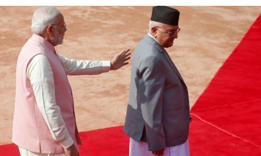
Nepal’s frantic reactions over Lipulekh and Kalapani with a new map of the country stems from Prime Minister KP Sharma Oli’s political domestic compulsions. China too appears to have a role in the background.
Nepal has released its new political map claiming Kalapani, Lipiyadhura and Lipulekh as its own territories. These areas fall under the Pithoragarh district of Uttarakhand and in the same region through which new Kailash Mansarovar route passes.
Nepal has included them as part of its Byas [Byans in India] Rural Municipality of Darchula district adjoining Pithoragarh.
Unveiling Nepal’s new political map that includes territories on Wednesday, central minister Padma Kumar Aryal expressed hope India will take it “in a positive way”. This is an unusual optimism to settle a boundary question.
Aryal did not elaborate her “positive” remark. Given the nature of India-Nepal relation, however, indicates that the Nepal government hopes India will factor in what is going on domestically in Nepal’s politics.
Nepal is being ruled by a relatively upstart political party, the Nepal Communist Party (NCP), which turned two over last weekend. The two-year-old party came into being with China’s ruling communist party after merger of two dominant communist parties of Nepal – the Marxist-Leninist and the Maoist.
Nepal’s Prime Minister KP Sharma Oli shares the chair of the Nepal Communist Party with Pushpa Kamal Dahal, more commonly known as Prachanda. Oli is from the Marxist-Leninist stream and Prachanda from Maoist faction.
Oli became the prime minister following an electoral victory in 2017 and a compromise between the two factions in the ruling party in 2018. But his position in the Nepal’s PMO has not been secure. There has been pressure on him to make way for a Maoist prime minister.
Wuhan Virus outbreak in Nepal and the failure of the Oli government to manage the disease in the country only mounted pressure on the prime minister, who was not ready to let go the reins of the power out of his hand.
Though, he once proposed to resign in favour of Bamdev Gautam. But the other factions, particularly the one under Prachanda and Madhav Kumar Nepal did not agree.
Then in the middle of Wuhan Virus outbreak, the Oli government promulgated two ordinances on April 20. They were not related to Wuhan Virus strategy. These laws amended the Political Parties Act of Nepal making it easier to split a party.
This move baffled political observers as the Nepal Communist Party has majority in the country’s parliament. This, however, exposed the fault-lines lying beneath the surface unity of the party, and also the growing pressure on Oli to quit.
The Kathmandu Post reported that the approval for the ordinances from President Bidya Devi Bhandari came while a secretariat meeting was underway to discuss the ordinances. The daily called it “well-choreographed move”.
Soon after the ordinances were brought out, the rival faction stepped up ante against Oli. Prachanda took charge of the rival faction forcing Oli to withdraw the ordinances in four days.
This was also the time when Chinese ambassador in Nepal got involved holding meetings with both factions and also with President Bhandari. A compromise was reached. But public opinion was going against the government and the ruling party.
Some time in between a strategy was devised to deflect public attention from crisis in the government and its failure to tackle Wuhan Virus crisis. National pride became the rallying point. Oli has a history of thriving on anti-India sentiments.
India soon opened new Kailash Mansarovar route through Lipulekh pass. Nepal protested. The November 2019 updated map released by India provided the launching pad.
India had released its new political map following creation of two Union Territories of Jammu and Kashmir, and Ladakh from erstwhile state of Jammu and Kashmir.
Nepal had then protested over inclusion of Kalapani in India’s map. India had then said its boundaries with Nepal had not been altered in the new map.
Six months later, Nepal has now released its new political map. Its old map obviously did not show Kalapani, Lipiyadhura and Lipulekh as its territories. These areas have not been under Nepal’s administration.
There is more to Kalapani story and Oli’s anti-India stance. During his first term as Nepal’s prime minister, there was a constitutional crisis in Nepal fueling anti-India sentiments with India unofficially imposing blockade for months. To counter India, Oli had signed a series of agreements with China.
His remark that novel coronavirus from India is more lethal than the variants from Italy and China, is convenient politicking to raise an anti-India sentiment among his political constituencies.
It was also during his first tenure that a committee had been formed in Nepal to look into the claim over Kalapani. The committee reported that Kalapani was occupied by India.
There is another contesting claim in Nepal. That Kalapani was included in their Census record till some sixty years ago.
Nepal’s Foreign Minister Mahendra Bahadur Pande had in 2015 claimed that Kalapani was “gifted” to India by King Mahendra Bikram Shah Dev of Nepal apparently in the aftermath of 1962 India-China war to prevent future incursions from China.
India has been patrolling and manning the border areas since then. India-Nepal border on the western flank is largely marked under the Treaty of Sugauli signed in 1816 between Nepal’s king and East India Company. The British had kept control of Kalapani.
The entire area in controversy is a geo-strategic vantage point for being a tri-junction – India, Nepal and Tibet — in rugged Himalayan terrain. China has been interested in happy sway over the area.
The current anti-India posturing by Nepal has clearly stemmed from Oli’s domestic political compulsions and his party’s pro-China stance. It is from this flux Nepal minister Aryal perhaps hoped India would take the new map of Nepal in a positive way. The new map does not change the ground situation. And, also the final boundary delineation would come from the boundary dispute settlement mechanism that involves the foreign secretaries of the two countries.


