
Geo Imaging Satellite GISAT-1 To Ensure a 24/7 watch on south Asia
Indian Space Research Organisation’s (ISRO) latest earth observation satellite GISAT-1, the launch of which was postponed by the space agency due to technical reasons on March 4, 2020, can keep a 24/7 watch on Indian subcontinent.
The geo-imaging satellite GISAT-1, which is one of the first-of-its-kind satellites, is equipped with a very powerful telescope and very sensitive imaging sensors which have been developed indigenously.
Explaining reasons for placing the earth-observation satellites in GEO, Padma Shri Dr Mylswamy Annadurai, Programme Director Chandrayaan 1 and Mangalyaan, Vice President TN State Council for Science and Technology, said, ‘’Satellites in Low earth orbit can only click an image of a particular spot only 2-3 times a day, when they make a pass, but satellites in geostationary orbit (In sync with the movement of the earth) can constantly monitor a vast area. When a satellite is placed in GEO, it can click pictures of a particular spot in India or any spot that is visible to it, almost 24/7.’’
When asked if the image quality will not be adversely affected due to its distance of nearly 36000 km from earth, Annadurai said, ‘’It is true that the resolution and quality of an image would be affected due to the 36,000 km orbit at which the satellite is placed, but besides optical cameras, we can also use other infrared-based imaging sensors that are part of the satellite.’’
Replying to a question if there were other Indian satellites apart from communication satellites which have been placed in GEO, Annadurai said, ‘’Some of our earlier satellites such as Kalpana, INSAT 3D and INSAT 3DR can click images 24/7. INSAT 3D and 3DR are utilized for communication, monitoring climate, environment and for disaster management system and are placed in GSO.’’
‘’These are the satellites that help us track changing weather patterns every 15 minutes. While the earlier ones were multi-purpose satellites, the current satellite GISAT-1 is a more advanced version dedicated mainly to earth observation and can give higher resolution images and incorporates a different kind of technology,’’ he added.
Dr. Mylswamy Annadurai also explained how the new technology will change the functionality of the satellite and said, ‘’Some of our earlier generations of satellites like INSAT series had a scanning mirror in them, that moved east-west in a sweeping motion as a part of the image capturing process. However, since the satellites were also used for communications purposes(and are required to move in such a way that it appears fixed over a particular spot above the equator), the satellite was only moving on its GEO (in sync with the angular velocity of the earth). But since the GISAT is dedicated mainly for different kinds of earth observation, the satellite itself can rotate on an east-west, north-south axis to enable imaging of a specific region. In layman’s terms, its like tilting a handheld camera and moving it for getting the best shot.’’
Meanwhile, Padma Vibhushan Dr G Madhavan Nair, former Chairman, ISRO, said revealed some of the real world applications of the GISAT -1.
Nair said, ‘’If we have a natural calamity in a particular region or a region that has to be monitored, we can issue commands for the satellite to point towards that specific region, or a weather pattern such as a cyclone and look at it in more detail. Low earth orbit satellites can give us better quality pictures, but they can make a pass only every 110minutes or so. But in the case of GISAT, we can continuously observe the area. So if a region is affected by forest fires or floods, we will know it near-real time and (if required) can deploy the satellites in Low Earth Orbit to click high-resolution pictures to improve our awareness of the situation.’’
Explaining why ISRO calls it the first state-of-the-art agile earth observation satellite from Geostationary orbit, Nair said, ‘’As far as India is concerned this is the first-of-its-kind satellite. Basically this is a technology breakthrough as it requires a very powerful telescope and very sensitive imaging sensors which we have developed indigenously. We have been working on this technology for sometime.’’
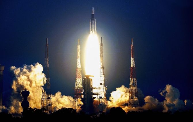
The launch of ISRO’s GSLV-F10 rocket carrying the geo-imaging satellite GISAT-1, that was scheduled for 5:43 pm on Thursday, was postponed by the ISRO due to technical reasons. ISRO has said that a revised launch date would be announced in due course.
The GSLV rocket will be carrying what ISRO calls a state-of-the-art agile Earth Observation Satellite into Geo Stationary Transfer Orbit(GTO), which is 36,000 km at its farthest point from earth and 170km at its nearest point to earth.
After it is placed in GTO, the satellite would be issued a series of commands to fire its Liquid Apogee Motor(LAM) for a few sequential burns, until it is placed in Geostationary orbit (GEO) of 36000km circular from where the satellite would be seen stationary to all the points from the earth.
According to ISRO, the satellite is meant to provide near real time imaging of large regions of interest at frequent intervals, quick monitoring of natural disasters, episodic events and also obtain spectral signatures for agriculture, forestry, mineralogy, disaster warning, cloud properties, snow & glaciers and oceanography.
While conventionally, earth-observation satellites are placed in Low-Earth orbit (between 500 and 2000kms), to ensure high resolution imagery, better capabilities, it is pertinent to note that ISRO’s latest agile earth-observation satellite is to be placed in 36,000kms away. The GEO orbit is generally meant for Communication Satellites that are required to relay signals across a vast landmass. Being placed in the 36,000km circular orbit would also mean that the 2268kg GISAT-1 is beyond the range of Anti-satellite missiles.


