
Indian Army creates an alternate route to connect Leh with Tangste
By
Robot Vats
Reports appearing in the Indian media on 31st August 2021 say that the Indian Army has created a new road connecting Leh with Pangong Tso lake. And since this road passes through 18,600 feet high Ke La pass, this will now be the highest motorable road in the world, surpassing the previous record held by Khardung La pass at 18,380 feet.
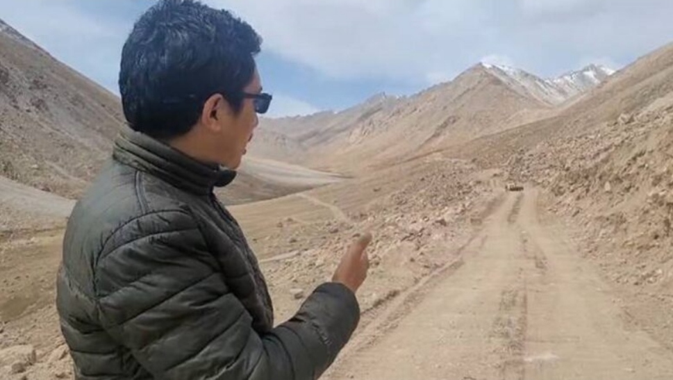
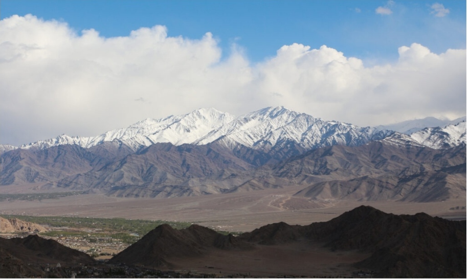
Images from the inauguration ceremony.
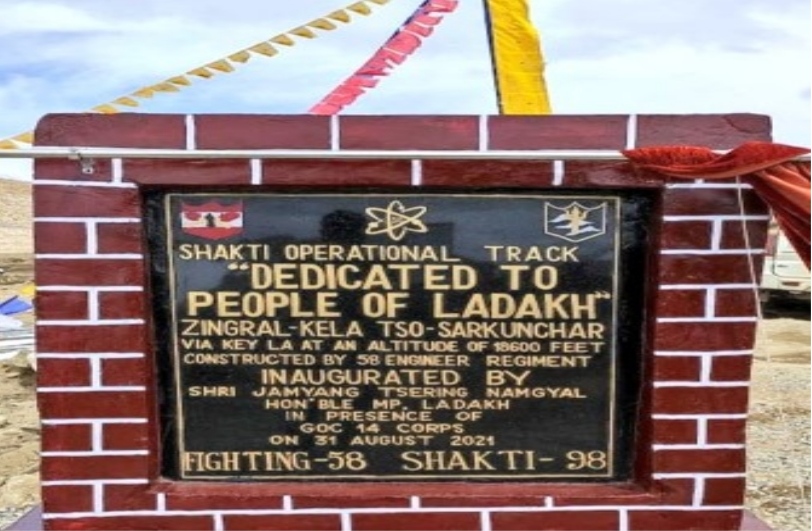
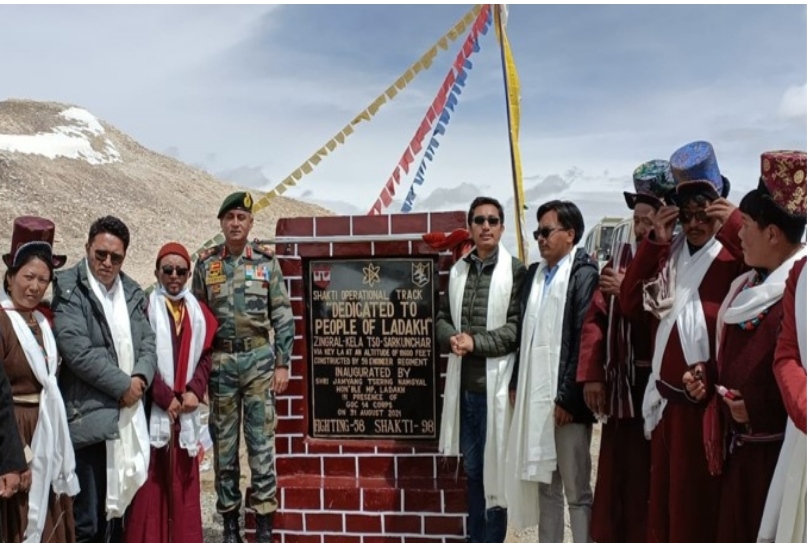
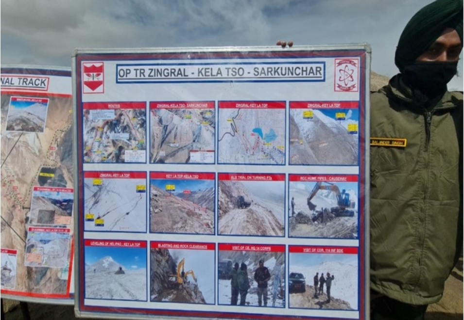
source: @ddnewsladakh
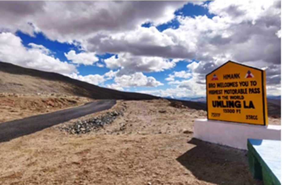
First things first. The highest motorable road in the world was recently inaugurated in south-eastern Ladakh and goes across the 19,300 feet high Umling La pass. And before it, a road in Bolivia which rose to 18,953 f held the record. So, no new record is being created. You would expect the media to check such ‘minor’ details but alas!
Now that we’ve addressed this tiny detail, lets understand the strategic significance of this new road alignment, beyond the fact that it passes through a 18,600 feet high pass!
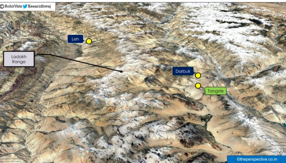
Before we proceed, here is a map which gives a general overview of the area and highlights key places, along with alignment of the Ladakh range.
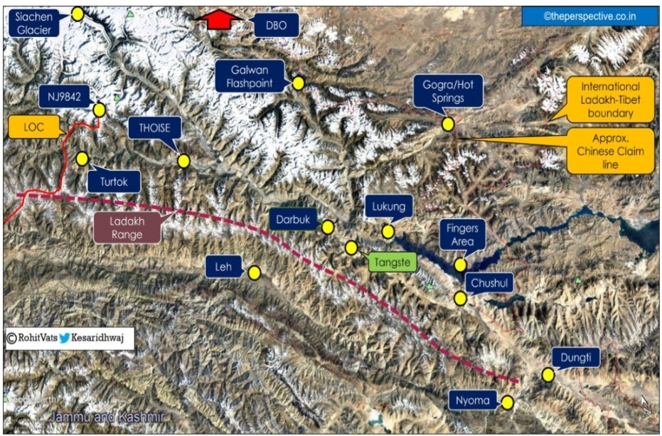
Ladakh Range – A forbidding barrier
The 370 km long Ladakh range emanates from a point close to confluence of Indus and Shyok river in Northern Areas of Pakistan Occupied Kashmir. It runs in a north-west to south-east direction and ends at Dungti. Dungti sits at the head of the Demchok funnel, the flat stretch of land along which the Indus River enters Ladakh from Tibet before it takes an almost 90 degree left turn at Dungti.
The average height of Ladakh range is more than 18,000 feet and it presents a major physical barrier from military perspective. This is because it limits any movement towards north (Nubra valley, Siachen), north-west (Turtuk, those, LOC), east (Darbuk, Tangste, Pangong Tso area, Fingers Area, Hot Springs/Gogra), and north-eastern (Daulat Beg Oldi area) part of Ladakh.
The satellite image below has the Ladakh range in the middle and it highlights how it forms a barrier between places/locations to its east and west.
Existing road connectivity
Leh is the centre of gravity when it comes to the Ladakh theatre, and the main economic and military node. It is also home to the only combined civil and military airfield in the theatre.
Movement of men and material (POL – Petroleum, Oil & Logistics) towards all the peripheral sectors of Ladakh theatre, whether towards west (facing Pakistan Occupied Kashmir), north (Siachen) or eastern Ladakh facing China, emanates from Leh.
However, as explained earlier, Ladakh range is the main physical barrier which restricts movement from Leh towards other sectors. This is because the roads connecting Leh with these sectors must cross high-altitude mountain passes in various directions.
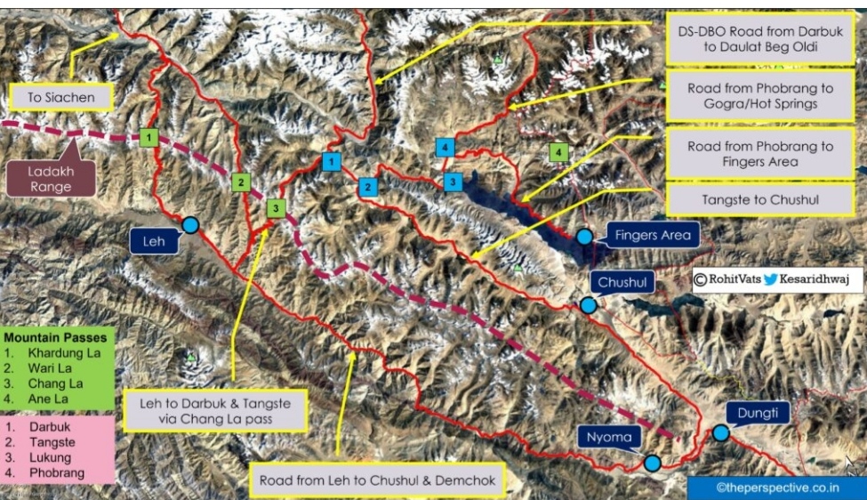
Key motorable mountain passes on the Ladakh range are as follows:
- Khardung La – The most famous and ‘touristy’ of the passes on the Ladakh range. One needs to cross Khardung La pass to reach Shyok and Nubra river valleys. From here, a road goes north towards Siachen Base Camp, and other road heads west towards the LOC with Pakistan Occupied Kashmir.
- Wari La – A lesser-known pass which has become operational in recent past. It also connects Leh, and the Indus valley with Shyok river valley.
- Chang La –
- The road starts from Leh and after crossing the 17,590 feet Chang La pass, reaches the eastern side of Ladakh range and connects with Darbuk and Tangste.
- While Darbuk is the starting point of newly commissioned Darbuk-Daulat Beg Oldi Road (DSDBO Road), Tangste is the gateway to Pangong Tso lake.
- It is also a major military node for northern part of Pangong Tso sector.
- A road also leads directly from Tangste towards Chushul.
- Road from Tangste also connects with Lukung and Phobrang towards north of the northern end of Pangong Tso lake.
- Lukung and Phobrang are both very critical from the perspective of defense of Chang Chenmo, Chushul and Pangong Tso sectors. Here is why:
- Because the road network towards the entire Chang Chenmo sector, where you have the Hot Springs and Gogra posts, starts from Lukung.
- Secondly, the roads towards strategically very important Ane La pass and the entire northern bank of Pangong Tso lake, till Finger 4, starts from Phobrang.
Reference map –
New Leh – Tangste Road
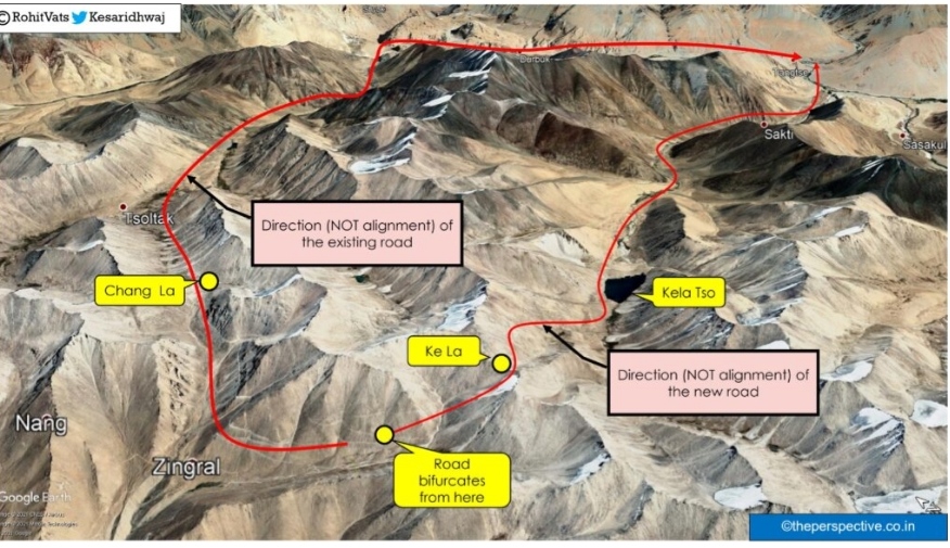
Basis the available information, a new road has been created by the Indian Army which will provide alternate connectivity between Leh and Tangste.
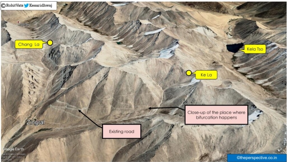
The new road bifurcates from the existing Leh-Chang La-Darbuk-Tangste road at a place called as Zingral. This location is approximately 12 kilometers before Chang La pass. From Zingral, the road turns south-east, crossing the 18,600 feet high Ke La pass, then turns east and descends to the valley which connects at its end with Tangste.
The alignment of the alternate route, and its location with respect to the existing route is shown in the map below:
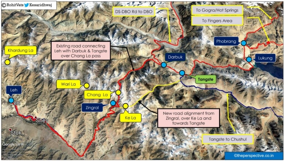
Closer look at the satellite images of the place from where the bifurcation happens:
Strategic importance of new road
Before this road became operational, the only direct connectivity between Leh and Tangste was over the Chang La pass. In case of any blockage due of Chang La pass, heither due to natural disaster or enemy action, the connectivity would’ve been severed. This would’ve impacts our defenses not only in the Pangong Tso sector but also in Chang Chenmo valley (Hot Springs, Gogra), Galwan, and Daulat Bed Oldi/Depsang Sectors.
The only other route available would’ve been the much longer Leh – Nyoma – Chushul – Tangste road. This is almost 350 km distance as compared to the existing ~125km long Leh – Chang La – Darbuk – Tangste road.
With the new alignment in place, the Indian Army now has an alternate connectivity between Leh and Tangste. In case the Chang La pass become blocked, or there is any other issue along this route, the IA can rely on the new road to continue to maintain its positions on eastern side of the Ladakh range. Not only that, but this new route is also supposed to be 41 km shorter than the existing route over the Chang La pass.
Conclusion
Basis the available images of the road, at present it is in the form of a track and is yet to be black topped. With winters nearing in Ladakh, I think the same is expected to happen over next working season in summer months.

